Cloud Types
Clouds are classified by their height in the atmosphere and appearance.
Clouds form at three height layers:
Clouds are also classifed by appearance containing the following words:
- Cirrus - wispy and thin.
- Cumulus - Puffy appearance.
- Stratus - Flat and/or layered.
- Nimbus - Contain Precipitation.
| Cloud Base Coverage |
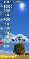
| No Metar |
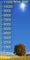
Metar |
| (Onsite Data) |
(EGAC - Belfast) |
 |
 |
- This script has been adapted from Bashewa's original Ver 2.1 script.
- The Original was for WD, Virtual Weather Station and WUHU.)
- Cloudbase CU Script
- It has now been adapted to work with Meteobridge.
- No Metar image is from the Weather Station Data
- Metar Data is from EGAC - Belfast Approx 8.2 miles away
- Data comparison may vary slightly due to altitude of WX
|
| View Detail |
View Detail |
High Level Clouds |
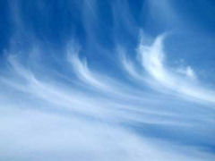 |
Cirrus (Ci)
- Cirrus are high clouds which are composed of ice cystrals that originate from the freezing of supercooled water droplets.
- They are thin and have a wispy appearance, and are often transparent.
- Usually indicates a change in weather will occur within 24 hours.
|
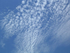 |
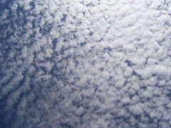
Cirrocumulus (Cc)
- Cirrostratus are high clouds, composed of ice crystals.
- Appear as small individual cloudlets in rows. No shading can be seen on the lower surface.
- Usually indicate fair weather for the near future.
|
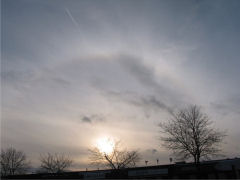 |
Cirrostratus (Cs)
- Cirrostratus are high clouds, composed of Ice Crystals.
- Thin and uniform appearance, Often covering the whole sky. A halo of the sun or moon can usually be seen through the cloud.
- Usually indicate rain or snow within the next 12 - 24 hours.
|
Mid Level Clouds |
 |
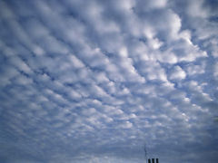
Altocumulus (Ac)
- Altocumulus are Mid level clouds composed of water droplets.
- Similar to Cirrocumulus, but have larger individual cloudlets, and shading can be seen.
- If seen in the morning, prepare for a thunderstorm in the afternoon.
|
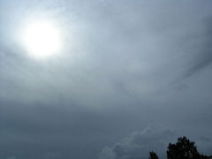 |
Altostratus (As)
- Altostratus clouds are mid level clouds composed of ice crystals and water droplets.
- Generally uniform and grey in appearance, and frequently cover the entire sky. The sun or moon may also be seen through them, but is usually quite fuzzy.
- Tend to indicate a storm some time in the very near future.
|
Low Level Clouds |
 |
Stratocumulus (Sc)
- Stratocumulus clouds are low level clouds composed of water droplets
- Appear as low patches or sheets of grey to white cloud, with individual rolls or rounded masses.
- Do not usually bring precipitation.
|
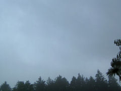 |
Stratus (St)
- Stratus clouds are low level clouds composed of water droplets.
- Appear as a uniform greyish layer and often cover the entire sky. They can sometimes cover hill tops.
- Often bring drizzle or light snow.
|
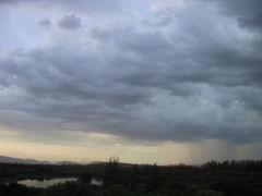 |
Nimbostratus (Ns)
- Nimbostratus clouds are low level clouds that might consist entirely of cloud droplets or raindrops, or of ice crystals and snowflakes.
- They are thick grey clouds with a ragged base. Sometimes they cover the entire sky.
- Indicate rain in the very near future.
|
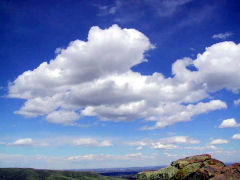 |
Cumulus (Cu)
- Cumulus clouds are low level clouds, composed of water droplets.
- They are have a puffy appearence, a flat base and are white or light grey.
- Indicate fair weather unless they grow vertically.
|
Vertically Developed Clouds |
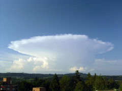 |
Cumulonimbus (Cb)
- Cumulonimbus clouds are Vertically Developed Clouds which are composed of water droplets and ice crystals.
- Appear dark and very tall often extending through all the levels of altitude, and can be several miles wide. They often appear in a shape similar to a mushroom.
- Usually indicate a storm in the near future. Rain, hail, thunder, lightning.
|
Other Clouds |
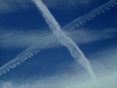 |
Contrails
- Contrails are visible trails of condensed water vapour made by the exhaust of aircraft engines.
|
wxcloud.php script originally supplied by Ian Cooke of http://www.chatteris.biz/