
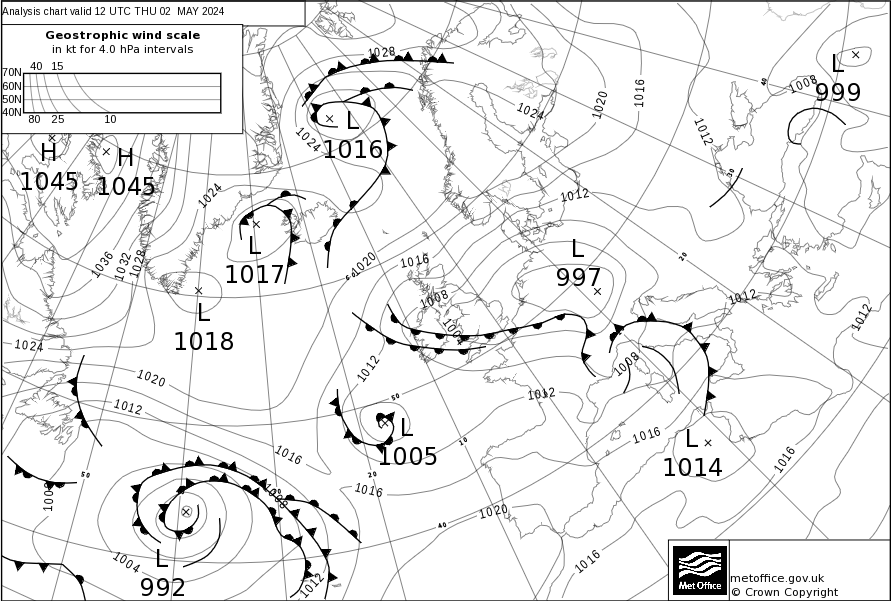
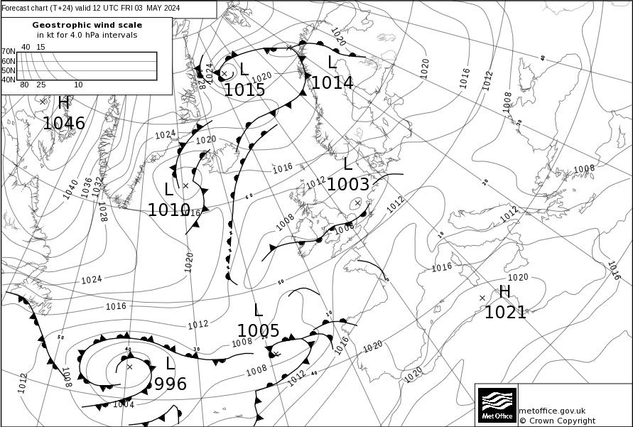
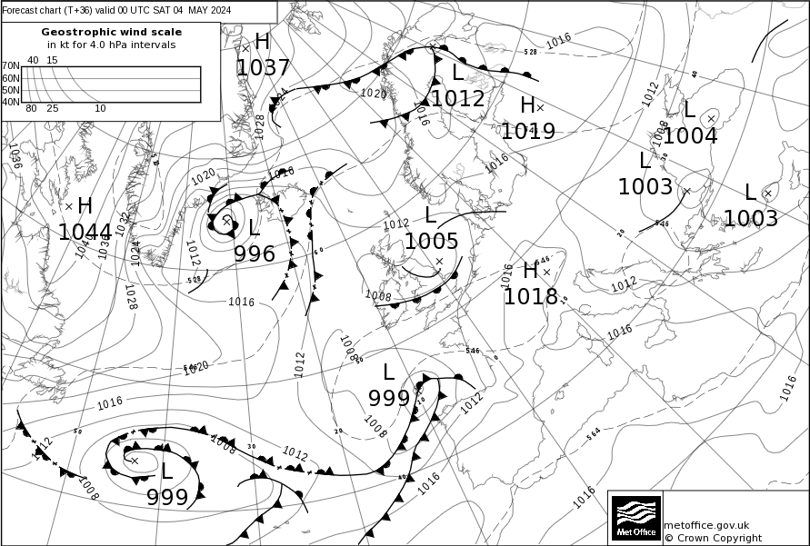
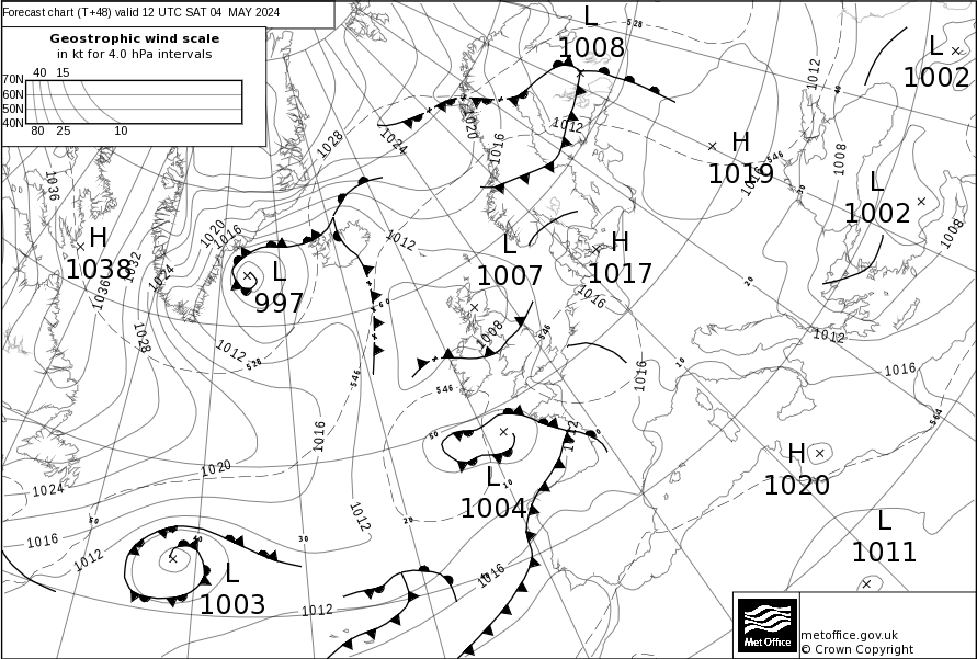
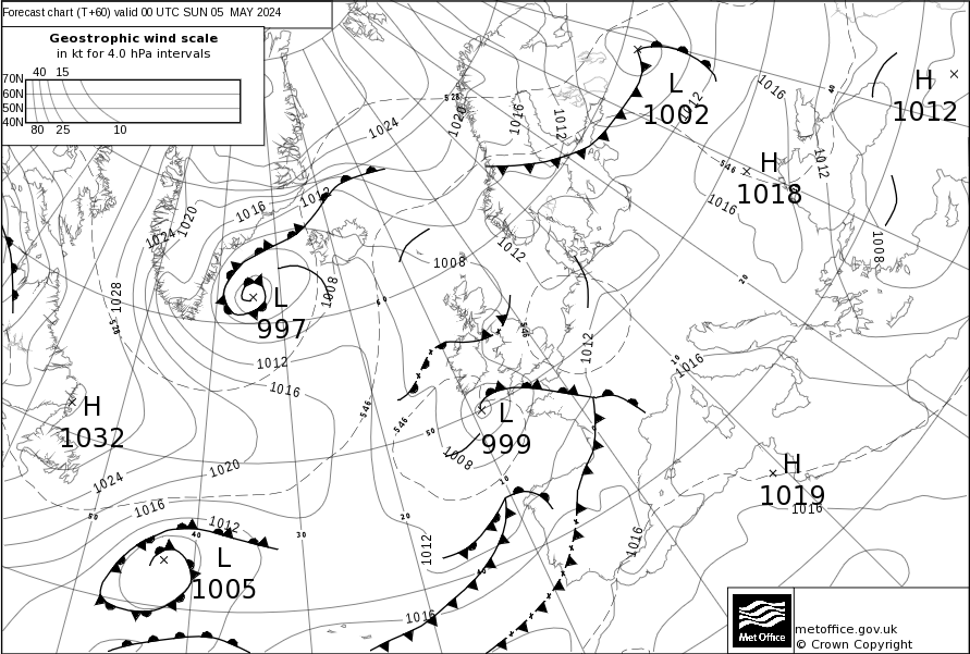
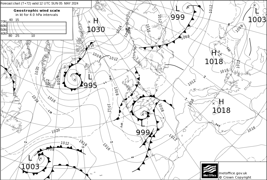
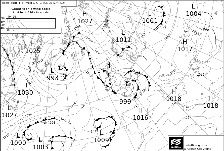
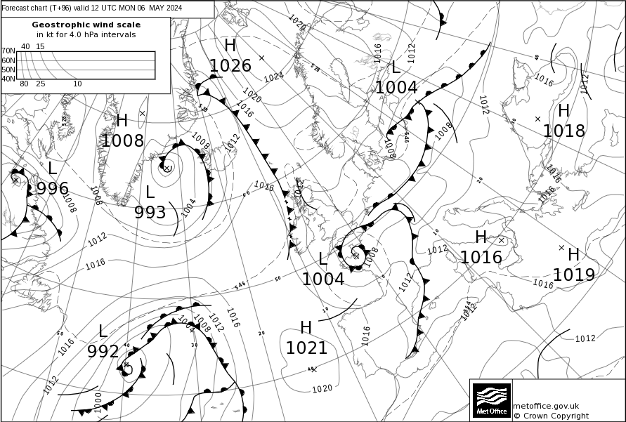
Surface Pressure Charts
Surface pressure charts showing pressure and weather fronts are provided up to five days ahead for Europe and the North East Atlantic.
These charts show the surface pressure pattern using isobars (lines of equal pressure) and indicate areas of high (H) and low pressure (L) along with their central pressure value. Isobars are represented by solid lines. High pressure is usually associated with settled weather while low pressure is normally associated with unsettled weather. Fronts are also displayed.
An analysis chart, which shows the observed state of the weather, is issued along with forecast charts up to five days ahead. These are updated every 12 hours around 0730 UTC and 1930 UTC, with the exception of charts for days four and five which are only issued once per day at 1930 UTC. The reason that these two charts are only issued once a day is because that far ahead the forecast surface pressure pattern will change more significantly, due to uncertainty at this longer time period, and there is limited value in updating it every 12 hours.
Latest Forecast
24 hr Forecast
36 hr Forecast
48hr Forecast
60hr Forecast
72 hr Forecast
84 hr Forecast
96 hr Forecast
120 hr Forecast
